


Agricola Voting District, George County, Mississippi
About
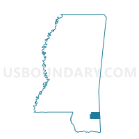
Outline

Summary
| Unique Area Identifier | 605383 |
| Name | Agricola Voting District |
| County | George County |
| State | Mississippi |
| Area (square miles) | 30.99 |
| Land Area (square miles) | 30.87 |
| Water Area (square miles) | 0.12 |
| % of Land Area | 99.62 |
| % of Water Area | 0.38 |
| Latitude of the Internal Point | 30.81829300 |
| Longtitude of the Internal Point | -88.50595220 |
Maps


Graphs
Select a template below for downloading or customizing gragh for Agricola Voting District, George County, Mississippi


Neighbors
Neighoring Voting District (by Name) Neighboring Voting District on the Map
- Barton Voting District, George County, MS
- Basin School Voting District, George County, MS
- Howell School Voting District, George County, MS
- Movella Voting District, George County, MS
- Pine Level Voting District, George County, MS
- Shipman Voting District, George County, MS
- Ward Voting District, George County, MS
Top 10 Neighboring County Subdivision (by Population) Neighboring County Subdivision on the Map
- District 2, George County, MS (5,003)
- District 3, George County, MS (4,739)
- District 1, George County, MS (4,388)